
- ArkEdge Space has launched ONGLAISAT, a compact CubeSat that captures high-resolution Earth images.
- The satellite operates at 410 kilometers above Earth, achieving an impressive resolution of 2.5 meters.
- ONGLAISAT provides detailed black-and-white imagery, showcasing urban and natural landscapes.
- This mission demonstrates the capabilities of small satellites in modern imaging technology.
- Results from the ongoing mission will inform future satellite projects beyond its March conclusion.
- The success of ONGLAISAT signifies a new era for small satellites in Earth observation.
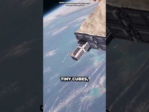
In a stunning leap for satellite technology, a Tokyo-based startup, ArkEdge Space, has unveiled ground-breaking images of Earth, all captured by a CubeSat no larger than a suitcase. This remarkable satellite, dubbed ONGLAISAT, soared 410 kilometers above our planet, snapping breathtaking photographs at an astonishing resolution of just 2.5 meters.
Imagine zooming in on the intricacies of bustling cities and the serene landscapes of places like Seattle and Argentina’s scenic Patagonia. These striking black-and-white images reveal roads and buildings in exceptional detail, reminiscent of traditional aerial photography—but achieved from a small satellite!
Equipped with state-of-the-art technology including a sophisticated optical system and advanced imaging sensors, ONGLAISAT achieved what ArkEdge claims to be the “world’s highest ground resolutions” for a CubeSat. This achievement not only showcases the potential of compact satellites but also opens the door for future missions with enhanced imaging capabilities.
The mission, which began in December, is set to conclude in March, but the knowledge gained will fuel upcoming projects well into the future. ArkEdge’s CEO expressed pride in the mission’s success, emphasizing the clarity of the images produced by such a small technological marvel, proving that size doesn’t dictate capability.
As we revel in these revolutionary images, one thing is clear: the era of small satellites is just beginning! Prepare for an exciting future where even the smallest spacecraft can unveil the mysteries of our planet.
Discover the Future of Earth Imaging: How ArkEdge’s CubeSat is Revolutionizing Satellite Technology!
Groundbreaking Innovations and Features of ONGLAISAT
The launch of ArkEdge Space’s ONGLAISAT represents a major leap forward in satellite technology and Earth observation capabilities. This ultra-compact CubeSat, measuring no larger than a suitcase, operates at an altitude of 410 kilometers, capturing high-resolution black-and-white images with an impressive detail of 2.5 meters. These images unveil urban landscapes and natural features with unprecedented clarity, pushing the boundaries of what small satellites can achieve.
Key Innovations:
– Advanced Optical System: ONGLAISAT is outfitted with cutting-edge imaging technology that allows it to capture high-quality images similar to those obtained by larger satellites.
– High Ground Resolution: The satellite achieves the highest ground resolution recorded for a CubeSat, challenging traditional views on the limitations of smaller spacecraft.
Use Cases and Applications
ArkEdge’s technology unlocks diverse applications across various sectors:
– Urban Planning and Development: City planners can leverage the detailed images for real-time monitoring of urban sprawl and infrastructure development.
– Environmental Monitoring: Researchers can analyze changes in natural landscapes, aiding in conservation and sustainability efforts.
– Disaster Management: The high-resolution images can assist in assessing damage and coordinating response efforts during natural disasters.
Market Trends and Forecasts
As the small satellite market expands, projections indicate a compound annual growth rate (CAGR) of over 18% from 2021 to 2028. The demand for nano and microsatellites, like ONGLAISAT, is expected to surge, driven by advances in technology, reductions in launch costs, and increasing applications in diverse fields.
Limitations and Future Directions
While ONGLAISAT’s technology is groundbreaking, there are limitations:
– Size Constraints: The compact nature of CubeSats can restrict payload options and operational capabilities.
– Orbital Lifespan: Smaller satellites typically have shorter operational lifetimes in orbit compared to larger counterparts.
Predictions and Insights
Experts believe that the integration of advanced imaging satellites will transform industries including agriculture, forestry, and urban studies. Continued innovation in satellite design and technology could result in even smaller devices that might achieve ultra-high resolutions and broad-spectrum imaging.
Frequently Asked Questions
1. What makes ONGLAISAT different from traditional satellites?
ONGLAISAT utilizes advanced optical technology to achieve high-resolution imaging from a compact form, demonstrating that smaller satellites can match larger ones in terms of image clarity and applications.
2. How does this new technology improve disaster response efforts?
The high-resolution images captured by ONGLAISAT can provide precise information to aid in assessing disaster zones, enabling quicker and more effective responses from emergency services and governmental agencies.
3. What are the long-term implications of enhanced CubeSat technologies for researchers?
The continuous development of CubeSats like ONGLAISAT will facilitate more frequent and affordable Earth observations, allowing researchers to conduct real-time monitoring and analyses with greater accuracy and speed.
For more related information, visit the main websites:
ArkEdge Space
CubeSat.org


