Wildlife Drone Telemetry Systems in 2025: How Next-Gen Aerial Tech is Transforming Wildlife Monitoring and Conservation. Explore the Innovations, Market Surge, and Future Impact of Smart Drones in Ecological Research.
- Executive Summary: Key Trends and Market Drivers in 2025
- Market Size and Forecast (2025–2030): Growth Trajectory and Projections
- Core Technologies: Sensors, AI, and Data Transmission in Drone Telemetry
- Leading Manufacturers and Industry Players (e.g., dji.com, sensefly.com, parrot.com)
- Applications: Wildlife Tracking, Anti-Poaching, and Habitat Mapping
- Regional Analysis: North America, Europe, Asia-Pacific, and Emerging Markets
- Regulatory Landscape and Industry Standards (e.g., faa.gov, easa.europa.eu)
- Challenges: Data Security, Battery Life, and Environmental Impact
- Case Studies: Successful Deployments by Conservation Organizations (e.g., wwf.org, conservation.org)
- Future Outlook: Innovations, Investment Trends, and Market Opportunities Through 2030
- Sources & References
Executive Summary: Key Trends and Market Drivers in 2025
The global market for wildlife drone telemetry systems is experiencing rapid evolution in 2025, driven by technological advancements, regulatory support, and the urgent need for more effective wildlife monitoring solutions. Drones equipped with telemetry payloads—such as GPS, radio, and satellite transmitters—are increasingly deployed by conservation organizations, research institutions, and government agencies to track animal movements, assess habitats, and combat poaching. The integration of artificial intelligence (AI) and machine learning for automated data analysis is a defining trend, enabling real-time insights and reducing manual labor.
Key industry players are expanding their offerings to meet the growing demand for robust, field-ready systems. DJI, the world’s largest commercial drone manufacturer, continues to innovate with ruggedized platforms and modular payloads tailored for environmental monitoring. senseFly, a subsidiary of Parrot Group, is recognized for its fixed-wing drones optimized for long-endurance wildlife surveys. Meanwhile, Quantum Systems is gaining traction with hybrid VTOL (vertical take-off and landing) drones that combine range and flexibility, increasingly favored for telemetry missions in remote or challenging terrains.
Telemetry hardware and software providers are also advancing rapidly. Lotek and Telonics are leading suppliers of animal-borne transmitters and receivers, now offering lighter, longer-lasting devices with improved data transmission capabilities. These are increasingly integrated with drone platforms for seamless data collection. The adoption of cloud-based data management and analytics platforms is accelerating, with companies like Wildlife Computers providing end-to-end solutions from tag deployment to data visualization.
Regulatory frameworks are evolving to support the responsible use of drones in conservation. In 2025, several countries have streamlined permitting processes for scientific and conservation drone operations, recognizing their value in biodiversity monitoring and anti-poaching efforts. This regulatory clarity is expected to further boost adoption rates.
Looking ahead, the market outlook remains robust. The convergence of miniaturized sensors, improved battery technology, and AI-driven analytics is expected to drive double-digit growth in the sector over the next few years. Strategic collaborations between drone manufacturers, telemetry specialists, and conservation organizations are anticipated to yield more integrated, user-friendly systems. As climate change and habitat loss intensify, the demand for precise, scalable wildlife monitoring solutions will continue to propel innovation and investment in drone telemetry systems.
Market Size and Forecast (2025–2030): Growth Trajectory and Projections
The global market for wildlife drone telemetry systems is poised for robust growth between 2025 and 2030, driven by increasing demand for advanced wildlife monitoring, conservation initiatives, and technological advancements in unmanned aerial vehicles (UAVs) and sensor integration. As of 2025, the market is characterized by a surge in adoption among conservation organizations, research institutions, and government agencies seeking efficient, non-invasive methods to track and study animal populations across diverse and often inaccessible terrains.
Key industry players such as DJI, a global leader in commercial and enterprise drones, continue to expand their product lines with UAVs capable of carrying sophisticated telemetry payloads, including GPS, radio, and satellite-based tracking modules. senseFly, a subsidiary of Parrot Group, is also notable for its fixed-wing drones tailored for long-endurance wildlife surveys, while Quantum Systems specializes in hybrid UAVs that combine vertical takeoff with extended range, supporting telemetry applications in remote habitats.
The integration of telemetry systems with real-time data transmission and cloud-based analytics is a defining trend, enabling near-instantaneous tracking and behavioral analysis. Companies like Trackimo and Telonics are recognized for their telemetry hardware and software solutions, which are increasingly being adapted for aerial deployment. These systems facilitate the collection of high-resolution location, movement, and physiological data, supporting both species-specific research and broader ecosystem management.
From 2025 onward, the market is expected to experience a compound annual growth rate (CAGR) in the high single digits, with projections indicating a doubling of market value by 2030. This growth is underpinned by rising investments in biodiversity monitoring, stricter regulatory requirements for environmental impact assessments, and the proliferation of public-private partnerships in conservation technology. The Asia-Pacific region, led by countries such as Australia and India, is anticipated to witness particularly strong expansion due to large-scale wildlife reserves and government-backed conservation programs.
Looking ahead, the outlook for wildlife drone telemetry systems is marked by ongoing innovation in sensor miniaturization, battery life, and AI-driven data processing. The entry of new manufacturers and the evolution of open-source telemetry platforms are expected to further democratize access to these technologies, broadening their application from flagship species tracking to comprehensive ecosystem surveillance. As a result, the sector is set to play an increasingly pivotal role in global wildlife conservation and research efforts through 2030 and beyond.
Core Technologies: Sensors, AI, and Data Transmission in Drone Telemetry
Wildlife drone telemetry systems are rapidly evolving, driven by advances in sensor miniaturization, artificial intelligence (AI), and robust data transmission technologies. As of 2025, these core technologies are enabling unprecedented capabilities in wildlife monitoring, behavioral analysis, and conservation management.
Modern wildlife telemetry drones are equipped with a suite of sensors, including high-resolution optical cameras, thermal imagers, LiDAR, and multispectral sensors. These payloads allow for detailed habitat mapping, animal detection, and health assessment from the air. Companies such as DJI and senseFly (a Parrot company) are at the forefront, offering drones with modular sensor bays that can be tailored for specific wildlife research missions. For example, DJI’s Matrice series supports interchangeable payloads, enabling researchers to switch between RGB, thermal, and multispectral sensors as needed.
AI integration is a defining trend in 2025. Onboard and edge AI processing allows drones to autonomously identify and track animals, distinguish between species, and even detect poaching activity in real time. Parrot and Teledyne FLIR are notable for embedding AI-driven analytics into their drone platforms and thermal imaging systems, respectively. These capabilities reduce the need for manual data review and enable rapid response to conservation threats.
Data transmission remains a critical component, especially for operations in remote or challenging environments. The latest telemetry systems leverage long-range radio, 4G/5G cellular, and satellite communications to ensure reliable data flow between drones and ground stations. UAV Factory (now part of Edge Autonomy) and Satcom Direct are advancing secure, high-bandwidth links that support real-time video streaming and sensor data relay over vast distances. These technologies are essential for live monitoring of migratory species or anti-poaching patrols in expansive reserves.
Looking ahead, the next few years will see further integration of AI and machine learning for predictive analytics, as well as the adoption of mesh networking to enable swarms of drones to collaborate on large-scale wildlife surveys. The convergence of these core technologies is expected to make wildlife drone telemetry systems more autonomous, scalable, and effective, supporting global biodiversity and conservation goals.
Leading Manufacturers and Industry Players (e.g., dji.com, sensefly.com, parrot.com)
The wildlife drone telemetry systems sector in 2025 is characterized by rapid technological innovation and the growing involvement of established unmanned aerial vehicle (UAV) manufacturers, as well as specialized telemetry solution providers. The market is led by a handful of global companies with proven expertise in drone hardware, sensor integration, and data transmission technologies, all of which are critical for effective wildlife monitoring and research.
DJI, headquartered in Shenzhen, China, remains the dominant force in the commercial drone industry. Its platforms, such as the Matrice and Mavic series, are widely adopted for wildlife telemetry due to their reliability, payload flexibility, and compatibility with third-party sensors and telemetry modules. DJI’s open SDK and robust flight control systems enable integration with GPS collars, thermal cameras, and real-time data links, making them a preferred choice for conservation projects worldwide. The company continues to expand its enterprise offerings, focusing on improved flight endurance and AI-driven object detection, which are directly relevant to wildlife tracking applications (DJI).
Another key player is Parrot, a French UAV manufacturer known for its ANAFI series. Parrot’s drones are valued for their lightweight design, ease of deployment in remote environments, and advanced imaging capabilities. The company has invested in open-source software and modular payloads, allowing researchers to customize telemetry systems for specific wildlife studies. Parrot’s collaborations with conservation organizations have led to the development of specialized solutions for animal tracking and habitat mapping (Parrot).
Swiss-based SenseFly, part of the AgEagle group, specializes in fixed-wing drones optimized for long-range, large-area surveys. SenseFly’s eBee series is frequently used in wildlife telemetry for its extended flight times and ability to cover vast, inaccessible terrains. The company’s focus on geospatial data accuracy and seamless integration with GIS platforms supports advanced telemetry workflows, including real-time animal movement analysis and habitat assessment (SenseFly).
In addition to these major manufacturers, several niche companies are emerging as important contributors. For example, Quantum Systems (Germany) and Delair (France) are gaining traction with hybrid VTOL (vertical takeoff and landing) drones that combine the endurance of fixed-wing aircraft with the versatility of multirotors. These platforms are increasingly being adopted for telemetry missions in challenging environments.
Looking ahead, the industry is expected to see further collaboration between drone manufacturers and telemetry technology specialists, with a focus on miniaturized sensors, improved data encryption, and AI-powered analytics. As regulatory frameworks evolve and demand for non-invasive wildlife monitoring grows, these leading players are well-positioned to drive innovation and expand the adoption of drone-based telemetry systems in conservation and research.
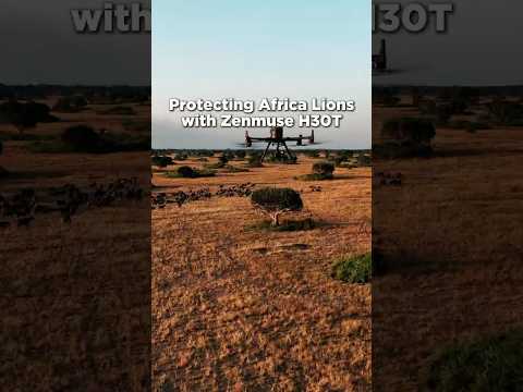
Applications: Wildlife Tracking, Anti-Poaching, and Habitat Mapping
Wildlife drone telemetry systems are rapidly transforming conservation efforts, with 2025 marking a period of accelerated adoption and technological refinement. These systems integrate unmanned aerial vehicles (UAVs) equipped with advanced telemetry sensors—such as GPS, radio, and satellite transceivers—to monitor animal movements, detect poaching threats, and map habitats with unprecedented precision.
In wildlife tracking, drones are increasingly deployed to follow migratory patterns, monitor endangered species, and collect behavioral data in real time. Companies like DJI, a global leader in commercial drone manufacturing, have developed UAV platforms compatible with telemetry payloads tailored for conservation. Their drones, often equipped with thermal imaging and long-range communication modules, enable researchers to track animals in dense forests or remote savannahs where traditional ground-based telemetry is impractical. Similarly, senseFly, a subsidiary of Parrot Group, offers fixed-wing drones capable of covering large territories, supporting long-duration wildlife surveys and habitat assessments.
Anti-poaching operations are another critical application. Drones equipped with telemetry and real-time video streaming are now routinely used to patrol protected areas, detect unauthorized human activity, and coordinate rapid response teams. Organizations such as Teledyne FLIR supply thermal imaging sensors that, when integrated with UAVs, allow for night-time surveillance and the detection of poachers or distressed animals. These systems are increasingly networked, with telemetry data relayed to centralized command centers for immediate action, a trend expected to intensify through 2025 as connectivity and AI-driven analytics improve.
Habitat mapping is also benefiting from advances in drone telemetry. High-resolution aerial imagery, combined with telemetry data, enables the creation of detailed 3D maps of ecosystems, supporting habitat restoration and land management. Companies like SPH Engineering provide drone mission planning and telemetry software that allows conservationists to automate complex mapping flights and integrate data from multiple sensors. This capability is crucial for monitoring changes in vegetation, water resources, and land use, especially in response to climate change or human encroachment.
Looking ahead, the next few years will likely see further integration of AI and machine learning into wildlife drone telemetry systems, enabling automated species identification, predictive movement modeling, and more efficient anti-poaching alerts. As regulatory frameworks evolve and costs decrease, the deployment of these systems is expected to expand from flagship reserves to smaller conservation projects worldwide, democratizing access to high-quality wildlife monitoring tools.
Regional Analysis: North America, Europe, Asia-Pacific, and Emerging Markets
The global landscape for wildlife drone telemetry systems is rapidly evolving, with distinct trends and developments across North America, Europe, Asia-Pacific, and emerging markets. As of 2025, these regions are experiencing varying levels of adoption, regulatory frameworks, and technological innovation, shaping the future outlook for wildlife monitoring and conservation.
North America remains a leader in the deployment and innovation of wildlife drone telemetry systems. The United States and Canada benefit from robust research funding, established conservation programs, and a mature drone industry. Companies such as DJI and Parrot supply advanced UAV platforms, while specialized telemetry providers like Lotek and Telonics integrate GPS, VHF, and satellite tracking for wildlife applications. Recent initiatives include large-scale monitoring of migratory birds, caribou, and endangered species, with data integration into national conservation databases. Regulatory clarity from agencies such as the FAA has facilitated research and commercial use, though privacy and airspace concerns persist.
Europe is characterized by strong regulatory oversight and a focus on biodiversity protection. The European Union’s environmental directives and funding mechanisms have spurred adoption of drone telemetry for habitat mapping and species tracking. Companies like senseFly (a Parrot company) and Quantum Systems are active in supplying fixed-wing and multirotor drones tailored for ecological research. Cross-border projects, such as monitoring wolf and lynx populations, are increasingly common, leveraging standardized telemetry protocols. The outlook for 2025 and beyond includes further integration with AI-driven analytics and expansion into Eastern Europe, where conservation needs are growing.
Asia-Pacific is witnessing rapid growth, driven by biodiversity hotspots and government-backed conservation efforts. In Australia, companies like Shearwater and Swoop Aero are collaborating with research institutions to monitor marine and terrestrial wildlife. Southeast Asian nations are deploying drones to combat poaching and deforestation, with increasing investment in telemetry-enabled UAVs. China’s expanding drone manufacturing sector, led by DJI, is making advanced systems more accessible, though regulatory harmonization remains a challenge. The region is expected to see continued growth as governments prioritize environmental monitoring.
Emerging markets in Africa and Latin America are beginning to adopt wildlife drone telemetry, often through international partnerships and NGO-led projects. While infrastructure and funding constraints persist, organizations are leveraging affordable UAVs and open-source telemetry solutions to monitor endangered species and combat illegal activities. Companies such as DJI and Parrot are key suppliers, with local adaptation and training programs underway. The outlook for these regions is positive, with anticipated increases in adoption as costs decrease and technical capacity improves.
Regulatory Landscape and Industry Standards (e.g., faa.gov, easa.europa.eu)
The regulatory landscape for wildlife drone telemetry systems is rapidly evolving as unmanned aerial vehicles (UAVs) become integral to ecological monitoring and conservation. In 2025, regulatory authorities are focusing on balancing technological innovation with safety, privacy, and environmental protection. The Federal Aviation Administration (FAA) in the United States continues to refine its Part 107 rules, which govern commercial drone operations, including those used for wildlife telemetry. These regulations require operators to obtain remote pilot certification, adhere to visual line-of-sight (VLOS) requirements, and comply with airspace restrictions—factors that directly impact the deployment of telemetry-equipped drones in sensitive habitats.
In Europe, the European Union Aviation Safety Agency (EASA) has harmonized drone regulations across member states, introducing a risk-based approach that categorizes operations as open, specific, or certified. Wildlife telemetry missions typically fall under the “specific” category, necessitating operational risk assessments and, in some cases, special authorizations. EASA’s framework emphasizes data protection and environmental considerations, which are particularly relevant for projects involving the tracking of endangered species or operations in protected areas.
Industry standards are also being shaped by organizations such as the Garmin Ltd., a leading manufacturer of telemetry and GPS tracking devices, and DJI, the world’s largest commercial drone producer. These companies are actively engaging with regulators to ensure their products meet evolving requirements for data security, electromagnetic compatibility, and interoperability with air traffic management systems. For instance, DJI’s drones are increasingly equipped with remote identification (Remote ID) features, aligning with FAA mandates for real-time drone identification and tracking.
Looking ahead, the next few years are expected to bring further harmonization of international standards, particularly as cross-border wildlife telemetry projects become more common. The International Organization for Standardization (ISO) is developing guidelines for UAV operations, which will likely influence both regulatory frameworks and industry best practices. Additionally, regulatory bodies are anticipated to introduce more nuanced rules for beyond visual line-of-sight (BVLOS) operations, which are critical for large-scale wildlife tracking in remote regions.
Overall, the regulatory and standards environment for wildlife drone telemetry systems in 2025 is characterized by increasing sophistication and collaboration between industry leaders, conservation organizations, and government agencies. This trend is expected to continue, fostering safer, more effective, and ethically responsible use of drone technology in wildlife research and management.
Challenges: Data Security, Battery Life, and Environmental Impact
Wildlife drone telemetry systems are rapidly advancing, but several critical challenges persist as the sector moves through 2025 and into the coming years. Chief among these are data security, battery life, and environmental impact—each presenting unique hurdles for manufacturers, conservationists, and regulatory bodies.
Data Security: As drones collect increasingly sensitive telemetry data—such as the real-time locations of endangered species—concerns about unauthorized access and data misuse are intensifying. In 2025, leading manufacturers are integrating advanced encryption protocols and secure data transmission standards to mitigate risks. For example, DJI, one of the world’s largest drone manufacturers, has implemented AES-256 encryption in its enterprise platforms to protect data in transit. Similarly, Parrot emphasizes secure data storage and transmission in its professional drone solutions, responding to the growing demand for privacy and compliance with international data protection regulations. However, as telemetry systems become more interconnected—often relying on cloud-based analytics—ensuring end-to-end security remains a moving target, especially in remote or cross-border deployments.
Battery Life: Limited battery capacity continues to constrain the operational range and duration of wildlife monitoring missions. Despite incremental improvements in lithium-polymer and lithium-silicon battery technologies, most commercial drones still offer flight times of 30–60 minutes under optimal conditions. Companies like senseFly (a subsidiary of AgEagle) and Quantum Systems are investing in lightweight airframes and energy-efficient propulsion to extend endurance. Hybrid power solutions—combining batteries with solar panels or fuel cells—are being piloted, but widespread adoption is hampered by cost, weight, and reliability concerns. In the next few years, incremental gains are expected, but transformative breakthroughs in battery chemistry or wireless charging are not anticipated before the late 2020s.
Environmental Impact: The ecological footprint of drone operations is under increasing scrutiny. While drones are less intrusive than traditional monitoring methods, their manufacture, deployment, and disposal raise sustainability questions. Companies such as senseFly are exploring recyclable materials and modular designs to reduce waste. Additionally, noise pollution and the potential for wildlife disturbance remain concerns, prompting the development of quieter propulsion systems and stricter operational guidelines. Regulatory bodies and industry groups are expected to introduce more rigorous standards for environmental stewardship, pushing manufacturers to adopt greener practices throughout the product lifecycle.
In summary, while wildlife drone telemetry systems are poised for continued growth and innovation, addressing data security, battery life, and environmental impact will be central to their responsible and effective deployment in 2025 and beyond.
Case Studies: Successful Deployments by Conservation Organizations (e.g., wwf.org, conservation.org)
In recent years, conservation organizations have increasingly adopted wildlife drone telemetry systems to enhance their monitoring and protection efforts. These systems, which combine unmanned aerial vehicles (UAVs) with advanced telemetry sensors, have enabled real-time tracking of animal movements, anti-poaching surveillance, and habitat assessment in challenging environments. Several high-profile case studies from 2023 to 2025 illustrate the transformative impact of these technologies.
One notable example is the deployment of drone telemetry by World Wide Fund for Nature (WWF) in African savannas to monitor elephant and rhino populations. By equipping animals with GPS collars and using drones to relay location data, WWF teams have been able to respond rapidly to poaching threats and track migration patterns with unprecedented accuracy. In 2024, WWF reported a significant reduction in poaching incidents in pilot reserves, attributing this success to the integration of drone-based telemetry and ground patrols.
Similarly, Conservation International has leveraged drone telemetry systems in the Amazon rainforest to monitor endangered primate species and assess the impact of deforestation. Their 2023-2025 initiative combined lightweight drones with radio telemetry receivers, allowing researchers to locate tagged animals in dense canopy environments where traditional tracking methods are ineffective. This approach has yielded critical data on species distribution and habitat use, informing targeted conservation interventions.
On the technology provider side, companies such as DJI and senseFly have played pivotal roles by supplying rugged, long-endurance drones tailored for conservation missions. DJI’s Matrice series, for example, has been widely adopted for its payload flexibility and integration with third-party telemetry modules. SenseFly, a subsidiary of Parrot Group, has focused on fixed-wing drones capable of covering large areas, which are particularly valuable for monitoring wide-ranging species and mapping habitats.
Looking ahead to 2025 and beyond, conservation organizations are expected to expand their use of AI-powered analytics and edge computing on drones, enabling real-time identification of animals and threats without the need for constant connectivity. Partnerships between NGOs, technology firms, and local governments are also anticipated to grow, fostering the development of open data platforms and standardized protocols for wildlife telemetry. As costs continue to decrease and regulatory frameworks evolve, the outlook for drone-based wildlife telemetry systems is one of increasing adoption and impact across global conservation efforts.
Future Outlook: Innovations, Investment Trends, and Market Opportunities Through 2030
The future of wildlife drone telemetry systems through 2030 is poised for significant transformation, driven by rapid technological innovation, increased investment, and expanding market opportunities. As of 2025, the integration of advanced sensors, artificial intelligence (AI), and real-time data transmission is reshaping how conservationists, researchers, and government agencies monitor and protect wildlife populations.
Key industry players are accelerating the development of specialized drones equipped with telemetry payloads tailored for wildlife tracking. Companies such as DJI, a global leader in commercial drone manufacturing, are increasingly collaborating with conservation organizations to adapt their platforms for ecological monitoring. DJI’s enterprise drones, for example, are being fitted with thermal imaging, GPS, and radio telemetry modules to enable non-invasive tracking of endangered species and anti-poaching operations.
Another notable innovator, senseFly (a Parrot company), is advancing fixed-wing drone solutions that offer extended flight times and large-area coverage, crucial for monitoring migratory patterns and habitat changes. These systems are being integrated with miniaturized telemetry tags and AI-driven analytics to automate species identification and behavioral analysis.
Investment in wildlife drone telemetry is also on the rise. Governments and NGOs are allocating greater resources to drone-based monitoring, recognizing its cost-effectiveness and ability to access remote or hazardous environments. For instance, the adoption of telemetry-enabled drones by national parks and wildlife reserves is expected to grow, supported by funding from international conservation bodies and public-private partnerships.
Looking ahead, several trends are likely to shape the market through 2030:
- Miniaturization and Battery Advances: Ongoing R&D is focused on reducing the size and weight of telemetry devices, enabling tracking of smaller species and longer drone flight durations. Companies like UAV Factory are investing in high-endurance platforms and lightweight sensor integration.
- AI and Edge Computing: The deployment of onboard AI for real-time data processing will allow drones to autonomously detect, classify, and track animals, reducing the need for manual intervention and accelerating data-driven decision-making.
- Global Expansion: As regulatory frameworks mature, emerging markets in Africa, South America, and Southeast Asia are expected to adopt wildlife drone telemetry at scale, addressing biodiversity loss and illegal wildlife trade.
By 2030, the convergence of these innovations is anticipated to make wildlife drone telemetry systems indispensable tools for conservation, research, and environmental management, with leading manufacturers and technology providers playing a central role in shaping the sector’s evolution.
Sources & References
- senseFly
- Lotek
- Telonics
- Wildlife Computers
- Trackimo
- Parrot
- SPH Engineering
- Swoop Aero
- European Union Aviation Safety Agency
- World Wide Fund for Nature (WWF)
- Conservation International